Local Communal Planning
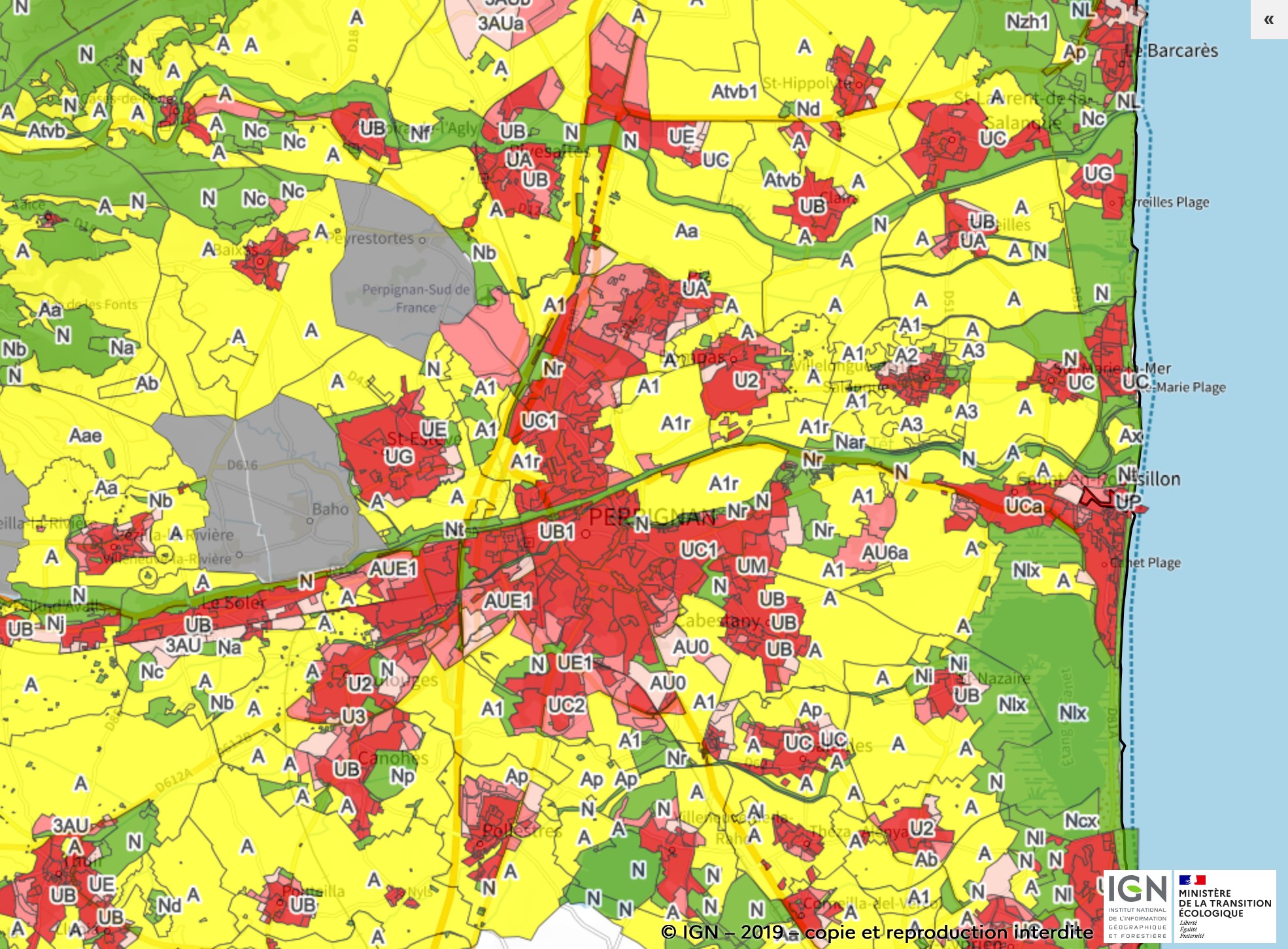
Orienting the commune's development over the long term, 10-15 years, the PLU plans its evolution through a territorial mapping of agricultural (A), natural (N), urbanised (U) and urbanisation zones, either immediately open or blocked (AU).
The Local Urban Plans (PLU) of Perpignan Métropole
32 communes of Perpignan Méditerranée Métropole now have such a tool (4 are covered by the Règlement National d'Urbanisme-RNU- since the POS will expire in 2021). Since September 10, 2015, the Communauté Urbaine has had jurisdiction over PLU and urban planning documents in lieu thereof within the perimeter made up of the 36 communes that make up its territory.
The enforceable PLUs of the communes of Perpignan Méditerranée Métropole are available below, and by clicking on the image opposite you can access the interactive cartography of the Géoportail de l'Urbanisme.
These local urban planning documents will be integrated into a wider planning tool, the PLUi-D (Plan Local d'Urbanisme intercommunal-Déplacements), which will enable us to pool our actions and the cost of urban planning studies, and make the territorial project drawn up by the mayors and community representatives fully operational.
It is in this perspective that, by deliberation of its Community Council, PMM prescribed its elaboration on 17 December 2015.